Environment and Overview of Cultures
Module 1
Introduction
The indigenous American Southwest is characterized by substantial environmental and cultural diversity. In this module you will become familiar with the physiographic and climatic setting of the region, and briefly review the major Native American groups that occupied this region.
|
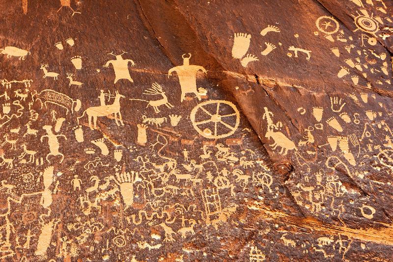
|
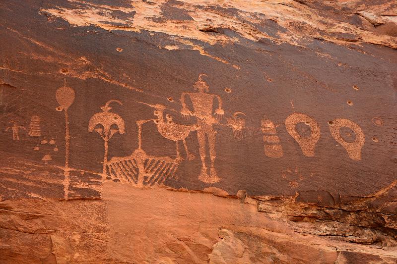
|
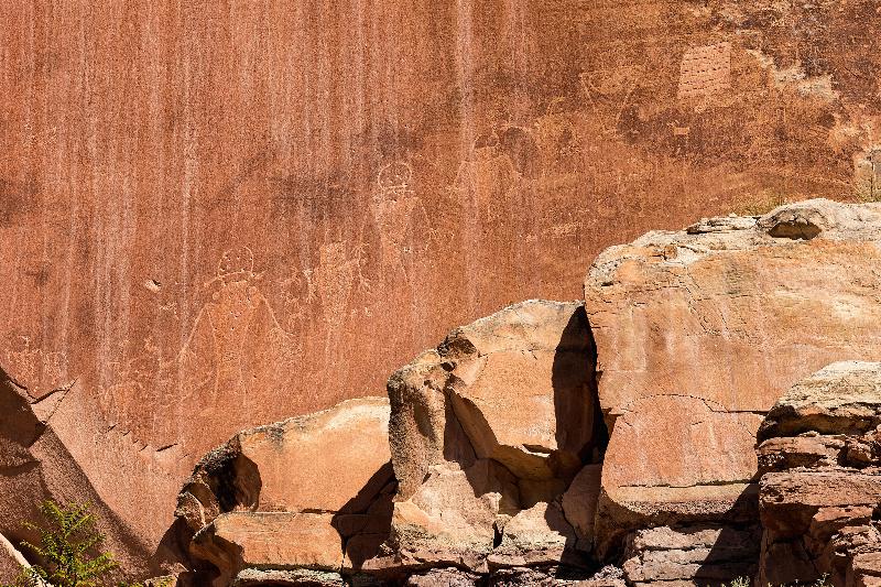
|
|
Petroglyphs or rock carving on Newspaper Rock, Utah, USA. Many of the tribes that we will study in this course have deep temporal connections with the Southwest. The rock art may have been produced centuries ago by ancestors of the modern Puebloan people.
|
Key Concepts
- Village farmers
- Rancheria settlement
- Forager-farmers
Learning Objectives
- Students will be able to describe the four major physiographic zones in the American Southwest, be able to identify which tribes traditionally called each zone their home, and be able to explain how the physiographic features of these zones impacted Native American social and subsistence organization
- Students will be able to describe the general climatic and environmental factors of the American Southwest and explain how these factors impacted Native American social and subsistence organizations
- Students will be able to describe the differences between village farmers, rancheria farmers, and forager-farmers, and be able to identify in what areas of the Southwest these different types of settlements were found when the Spaniards arrived.
Assigned Readings
- Griffin-Pierce Ch. 1
- Pp. 33-50 of Linda Cordell (1997) Southwest Environment
Click next page to continue.
Overview
|
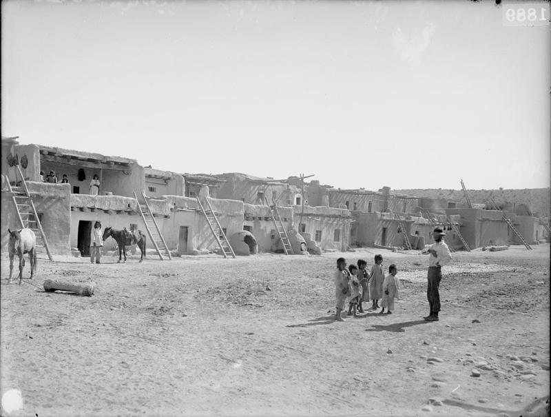
Jemez Pueblo, New Mexico. 1889
|
For the purposes of this course, the American Southwest includes all of Arizona and New Mexico, the southernmost portions of Utah and Colorado, the southeastern portion of Nevada, and the northwestern Mexico. At contact, three major types of economic adaptations were practiced by the Native American groups that lived here. These were village farming, rancheria farming, and foraging and farming.
Village farmers lived in large, compact villages that housed several hundred people and practiced intensive agriculture. Village farmers were exclusively Puebloan groups who lived along the Rio Grande and its tributaries and on the Colorado Plateau.
|
|
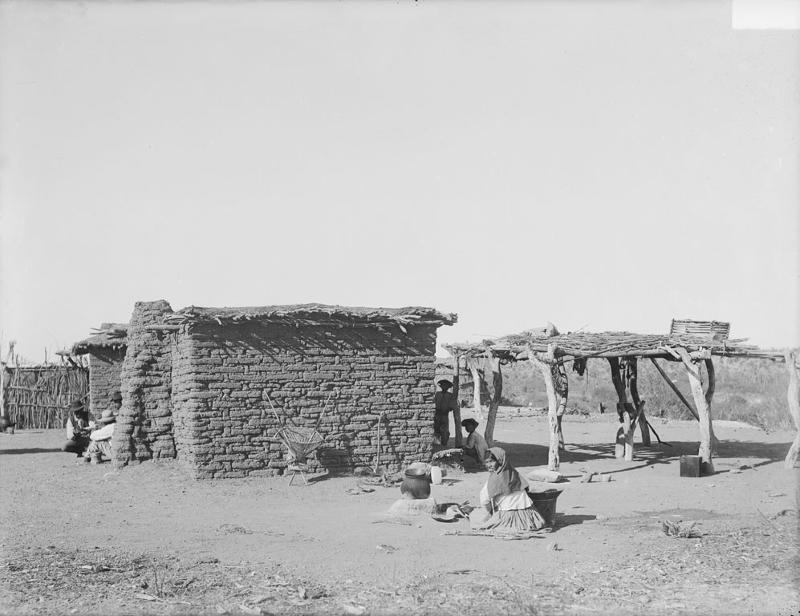
Tohono O'odham rancheria settlement, 1894
Source: SRIS - BAE GN 02785E 06425800, National Anthropological Archives, Smithsonian Institution, Dinwiddie, William
|
Rancheria farmers also were intensive agriculturalists, but rather than living in compact villages their communities consisted of dispersed farmsteads separated from one another by distances of as much as half a mile. The O'odham (also known as the Pimans and Papagos), the River Yumans, and the Yaqui were all rancheria farmers.
|
|
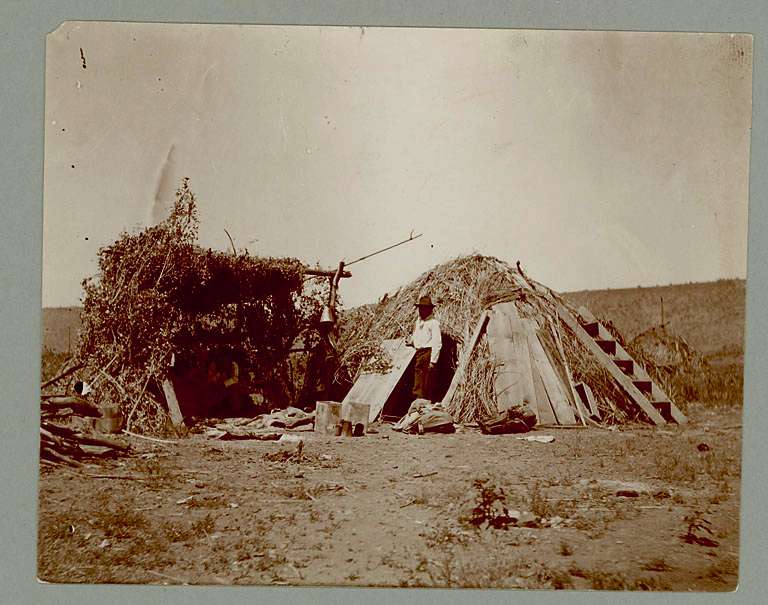
Apache wickiup. 1901. Because forager-farmers did not live in one location for very long, their structures tended to be made of temporary materials.
Source: SPC Sw Apache No # Habitations 02082900, National Anthropological Archives, Smithsonian Institution
|
Forager-farmers were people that lived primarily off of wild resources, but who supplemented these foods with limited amounts of cultivated products. Because farming was only a supplement to hunting and collecting, farmer-foragers tended to be highly mobile, moving around from location to location throughout the year. In the American Southwest, the Upland Yumans, Navajo, Apaches, and Southern Paiutes were all farmer-foragers.
Forager-farmers were people that lived primarily off of wild resources, but who supplemented these foods with limited amounts of cultivated products. Because farming was only a supplement to hunting and collecting, forager-farmers
tended to be highly mobile, moving around from location to location throughout the year. In the American Southwest, the Upland Yumans, Navajo, Apaches, and Southern Paiutes were all forager-farmers.
|
Click next page to continue.
Traditional Territories of Southwest Indian Groups
This is an interactive map, introducting the different Indian groups in the southwest territory, mouse over the tribal group names and click each name to learn more information.
Click next page to continue.
Physiographic Provinces
The American Southwest encompasses a tremendous amount of physiographic diversity that falls within four different environmental zones. These zones are:
- Colorado Plateau,
- The southernmost portion of the Rocky Mountains,
- The Central Mountains, and
- The Desert Basin and Range
Click next page to continue.
Climate and Environmental Zones
Several aspects of the Southwestern climate are relevant to understanding the cultural adaptations of the Native American indigenous people who made this region their home. These include:
- Substantial temporal and spatial variability in rainfall and temperature patterns
- Short growing seasons in the higher elevations
- Limited moisture in all but the highest of elevations, and
- A summer dominant or bimodal precipitation pattern, in which rainfall is limited to short periods of the year
Plants in the Southwest have adapted to these conditions in a number of ways. For example, many produce seeds only during periods of abundant moisture, and most grow only where micro-environmental conditions are adequate. Thus, very large stands of edible plants are rare—instead, plants tend to be dispersed widely across the landscape. Additionally, an area that contains abundant edible plants one year may have few or none the following year. For Native Americans that lived off the landscape, this meant that they had to be intimately familiar with the plants and the yearly growing conditions across a large territory, and that they had to be prepared to move across large distances to find enough food to eat.
|
|
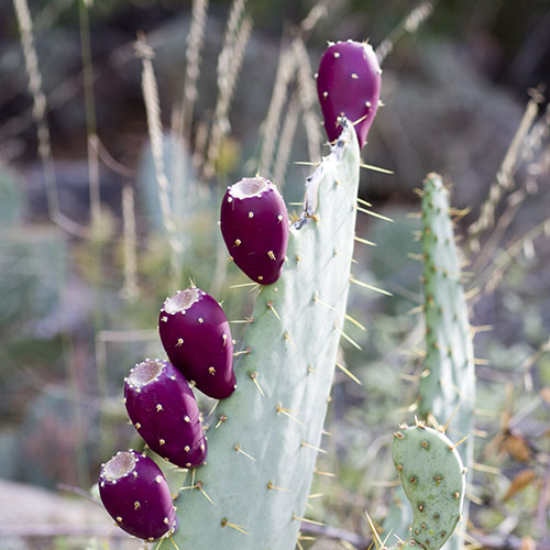
Cactus fruits were a reliable food source. However, they are dispersed across the landscape and gathering enough fruit for a even a small group of people required access to large tracts of land.
|
|
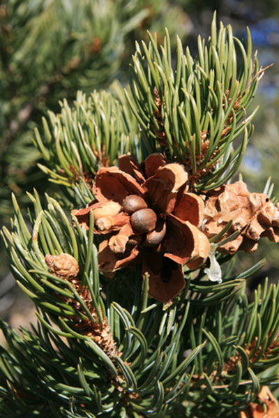
Pinyon nuts provided a nutritional and high calorie source of food for Native Americans. But their productivity is highly variable. A successful pine nut harvest required that tribes monitored large tracts of land to determine which stands of pinyon pines would be productive in any given year, and that they be prepared to travel the distance required to reach the productive tract.
|
Similarly, Native Americans had to develop innovative methods to cultivate crops in this region. These methods included developing plants adapted to growing under arid conditions, planting in a variety of different micro-environmental settings, and using a variety of different methods to capture the limited and often unpredictable water that was available. Additionally, because crop failures were common, they developed a number of mechanisms for storing and redistributing food.
This is an interactive map, showing the different environmental zones. Mouse over the environmental zones and click each zone to learn more information.
Click next page to continue.
Read the article on Cordell 1987
Practice Quiz...


